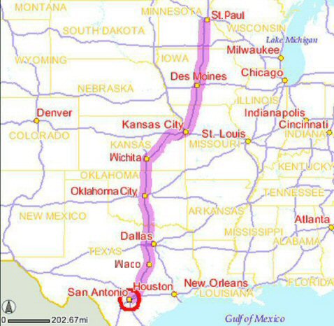
 We travelled from St.Paul, Minnesota to San Antonio, Texas over the 4th of July 2004. Our purpose
was to visit my step-son who is learning to be a National Guard medic at Fort Sam Houston.
Here is a map of our route. We the trip was approximately 1250 miles each way. We made
the trip in a 2002 Chrysler Town and Country mini van, always going about 5 miles over
the speed limit. The speed limit was 70 MPH in Minnesota, Missouri, Kansas, Oklahoma, and Texas.
Iowa, for some reason, has an interstate speed limit of 65.
| From: | To: | ~Mileage: |
~Duration: |
| St. Paul, MN | Des Moines, IA | 240 miles |
3 hours 20 min |
| Des Moines, IA | Kansas City, MO | 175 miles |
2 hours 30 min |
| Kansas City, MO | Wichita, KA | 200 miles |
2 hours 40 min |
| Wichita, KA | Oklahoma City, OK | 150 miles |
2 hours |
| Oklahoma City, OK | Dallas, TX | 175 miles |
2 hours 20 min |
| Dallas, TX | Waco, TX | 100 miles |
1 hour 20 min |
| Waco, TX | Austin, TX | 100 miles |
1 hour 20 min |
| Austin, TX | San Antonio, TX | 100 miles |
1 hour 20 min |
| | | ========== |
============= |
| | | 1240 miles |
16 hours 50 min |
|
|
|
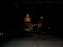 We left after work on Wednesday, July 1st. We drove to Des Moines and spent the night. Margaret
and I walked to the Iowa State Capitol building, which was about 5 blocks away from our
hotel. This picture is not very good - I really need to spend time practicing taking pictures
of objects at night...
|
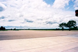
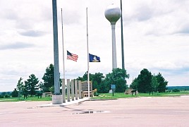 Here we are at a rest stop on the Kansas turnpike during what was a very very long day
of driving. The landscape is flat and wide open. The flag is at half staff because we
are at the tail end of the official morning period for ex-president Ronald Reagan.
|
 My travel companions, upon being told we are in Oklahoma. Their reactions run the
emotional range. We all noted the deep red color of the soil. Even the rivers were
this color. I have to record my observations upon reaching Texas. First of all, the
first building you see upon crossing the border on I35 is a porno store with a huge
sign. Everywhere in Texas there are porno shops everywhere, with huge signs. By comparison,
every other state seems to hide their porno shops in seedy out-of-the-way places where they blend
into the background. Not Texas. Texas porn is loud and proud - right next to the freeways
with giant signs unabashedly announcing exactly what is to be found. The other thing I
noticed right away was, by comparison, there were far more state troopers on the road than
in any other state. So beware. And I swear to God they do have roadside signs that proclaim,
"Don't mess with Texas".
|
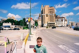 Here we are in downtown San Antonio on our way to visit the Alamo, that symbol of Texas.
It is very easy to reach the Alamo - it's right off the freeway. The modern city of
San Antonio grew up and in some sense eclipsed the Alamo. Their's hotels and other
modern buildings right across the street. The Alamo is just ahead, in the green clump
of trees.
The Alamo in 1836 occupied the grounds and buildings of former
Mission San Antonio de Valero. Used as a military post since the early
1800s, the Texans had barricaded openings and mounted at least
nineteen cannon before the 13-day siege.
|
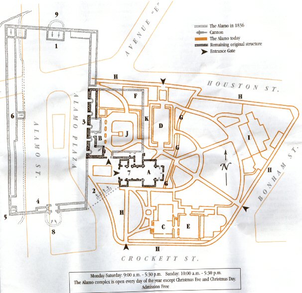
1  The North Wall (Travis' position)
2  The Palisade (Crockett's position)
3  The Long Barrack (Infantry and
    Artillery quarters)
4  The Low Barrack (Bowie's quarters)
5  Position of the 18-pound cannon
6  Alamo Headquarters
7  Church (Powder magazine, quarters,
    artillery position)
8  South Redoubt (earthworks)
9  North Redoubt (earthworks)

A The Shrine. The Shrine is dedicated
   to the memory of the men who fell in
   defense of the Alamo.
B Long Barrack Museum. Built using the
   remains of the original Long Barrack,
   the museum opened in 1968 and houses
   exhibits on the Alamo's historic past
   as well as the Clara Driscoll Theater.
C The DRT Library. Dedicated in 1950,
   the DRT Library contains books and
   documents on Texas History.
D Sales Museum. Built in 1936, the Sales
   Museum contains both the gift shop and
   exhibits on Texas History.
E Alamo Hall. A former San Antonio city
   fire station, the building now serves
   as a meeting hall.
F Cavalry Courtyard. This area was used
   as a stock pen during the siege.
G Acequia. The waterway marks the remains
   of the irrigation system that served
   the Spanish communities along the
   San Antonio River.
H Stone Walls and Arcade. The stone walls
   and arches that surround the Alamo have
   been erected since the 1920s.
I Comfort Area. Restrooms, vending machines
   and benches are located at the rear of
   the Alamo grounds.
J Convento Courtyard. The well dates back
   to the Mission Period.
K Wall of History. Dedicated in 1997, this
   outdoor exhibit tells the history of
   the Alamo from mission to modem times.
|
|
Originally named Mission San Antonio de Valero, the Alamo served as
home to missionaries and their Indian converts for nearly seventy
years. Construction began on the present site in 1724. In 1793,
Spanish officials secularized San Antonio's five missions and distributed
their lands to the remaining Indian residents. These men and
women continued to farm the fields that had once been the mission's but were now
their own, and thus participated in the growing community of San Antonio.
In the early 1800s, the Spanish military stationed a cavalry unit at
the former mission. The soldiers referred to the old mission as the
Alamo (the Spanish word for "cottonwood") in honor of their
hometown Alamo de Pan-as, Coahuila. The post's commander established
the first recorded hospital in Texas in the Long Barrack. The Alamo
was home to both Revolutionaries and Royalists during Mexico's ten-year
struggle for independence. The military - Spanish, Rebel,
Mexican - continued to occupy the Alamo until the Texas Revolution.
San Antonio and the Alamo played a critical role in the Texas Revolution.
In December 1835, Ben Milam led Texan and Tejano volunteers against
Mexican troops quartered in the city After five days of house-to-house
fighting, they forced General Martin Perfecto de Cos and his soldiers
to surrender. Cos was the brother-in-law of the ruler of Mexico, General
Antonio Lopez de Santa Anna.
The victorious volunteers then occupied the Alamo which was
already fortified prior to the battle by Cos' men and further strengthened
its' defenses. Meanwhile, Santa Anna felt the surrender to be a
personal affront to his family name. On February 23, 1836, the
arrival of General Santa Anna's army outside San Antonio nearly caught the defenders
by surprise. Undaunted, the Texans and Tejanos prepared to defend
the Alamo together. The defenders held out for 13 days against Santa
Anna's army. William B. Travis, the commander of the Alamo, sent
forth couriers carrying pleas for help to communities in Texas. On
the eighth day of the siege, a band of 32 volunteers from Gonzales
arrived, bringing the number of defenders to nearly two hundred.
Legend holds that with the possibility of additional help fading,
Colonel Travis drew a line on the ground and asked any man willing
to stay and fight to step over - all except one did. As the defenders saw
it, the Alamo was the key to the defense of Texas, and they were ready
to give their lives rather than surrender their position to General
Santa Anna. Among the Alamo's garrison were Jim Bowie, renowned
knife fighter, and David Crockett, famed frontiersman and former
congressman from Tennessee.
The final assault came before daybreak on the morning of March 6,
1836, as columns of Mexican soldiers emerged from the predawn
darkness and headed for the Alamo's walls. Cannon and small arms
fire from inside the Alamo beat back several attacks. Regrouping, the
Mexicans scaled the walls and rushed into the compound. Once inside,
they turned captured cannon on the Long Barrack and church, blasting
open the barricaded doors. The desperate struggle continued until the
defenders were overwhelmed. By sunrise the battle had ended and
Santa Anna entered the Alamo compound to survey the scene of his victory.
While the facts surrounding the siege of the Alamo continue to be
debated, there is no doubt about what the battle has come to symbolize.
People worldwide continue to remember the Alamo as a heroic
struggle against overwhelming odds- a place where men made the
ultimate sacrifice for freedom. For this reason the Alamo remains
hallowed ground and the Shrine of Texas Liberty.
|
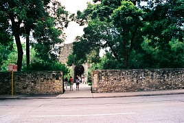
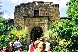 We approached the Church from the rear entrance.
|
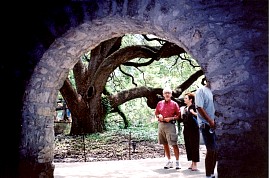
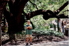 Looking out from the Long Barracks to the Convento Courtyard, where this huge, old
live oak resides.
|
|
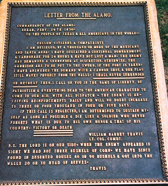
   Above left: Here is a plaque giving the contents of a letter sent from the Alamo to
               solicit help.

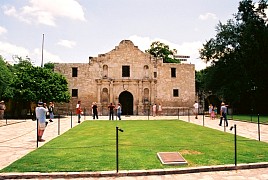
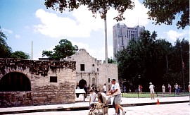
    Top right: Here is the front of the church, the view of the Alamo that you always see.
               The enlargement is the tablet seen in the foreground.

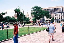
 Middle right: View from near the church looking outward.

 Bottom right: Another view of the church from farther away.
|
 We travelled from St.Paul, Minnesota to San Antonio, Texas over the 4th of July 2004. Our purpose
was to visit my step-son who is learning to be a National Guard medic at Fort Sam Houston.
Here is a map of our route. We the trip was approximately 1250 miles each way. We made
the trip in a 2002 Chrysler Town and Country mini van, always going about 5 miles over
the speed limit. The speed limit was 70 MPH in Minnesota, Missouri, Kansas, Oklahoma, and Texas.
Iowa, for some reason, has an interstate speed limit of 65.


