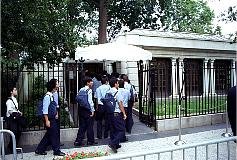
 I drove into Washington at 5:30 a.m.
and drove to the Visitors center, parking on the street nearby. I waited
in line for about an hour and then at 7:00 a.m. the line for same-day
tickets for the White House tour began to move. There were only 9 tours
given at 15 minute intervals between 10:00 am and noon. I got tickets
for tour #7: plenty of folks left without them. The moral is get there
early. After getting tickets I returned to the hotel for my family.
Here is where the tour of the White House begins. Your congressman
may be
able to get you advance tickets if you give them plenty of warning.
|
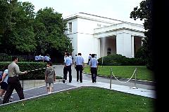 One walks up the driveway and enters the ? and goes through security.
At the head of the line looking back. You can only get four tickets - they stamp your hand with
ultraviolet dye and one person in every group must have that stamp.
Everyone has to have a ticket - even children.
|
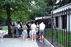 You can't take pictures in the White House. I was talking to one of
the guides/security people in one of the "colored" rooms when he quickly
excused himself and went after a guy taking pictures. "I told you once,
you won't listen to me, will you?" he told the guy. The picture taker's
tour was immediately terminated and he was escorted out. I asked a
policeman outside about the film and he said most likely it would be
"accidently" exposed as the man was escorted out.
|
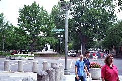 Pennsylvania Avenue is closed to automobile traffic for security. The
White House is around the corner to the left. Straight down to the left
is the southeast corner of Lafayette Park, which is across from the White House.
This statue is a memorial to Marquis de
Lafayette, a major-general in George Washington's Revolutionary War Army.
|
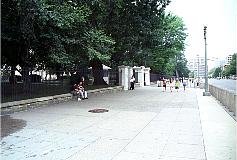 View along Pennsylvania avenue with the White House to the left.
The near gate is the pedestrian gate, the second gate
is for automobiles. Way down,very hard to see, is another gate for autos.
|
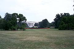 The front of the White House.
|
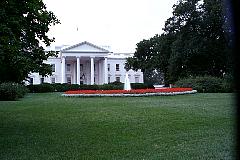 The White House was only adopted as the site's
official name during the Theodore Roosevelt
administration. The President's House, as it
was first called, was the first official building of
Washington, constructed before the Capitol or any of
the monuments. George Washington chose the site
for the President's House. He loved the view offered
by the downhill swoop to the Potomac. Despite having chosen its location, George Washington never got the chance to sleep,
much less live, at the White House. But all other presidents since John Adams have lived at the White House.
|
 A competition was held to find the design for the executive mansion. One of the entries received was a simple Roman design
submitted by none other than Thomas Jefferson. Perhaps had Jefferson signed his own name rather than with pseudonym to his
entry, his design might have won the competition. Instead, the man who won, and received the $500 prize money, was James
Hoban, a little-known, self-taught craftsman from Ireland. His winning design was based on a classical Irish manor near Dublin.
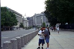
Looking east down Pennsylvania avenue, you see the Treasury building
to the right.
|
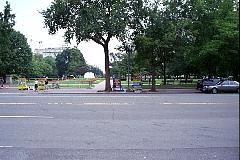 Originally called the President's Park, Lafayette Park earned its name in 1824
when Revolutionary War hero Marquis de
Lafayette made a visit there. During his say, the city welcomed Lafayette with
numerous dinners and receptions. The park where the festivities took place was re-named in his honor.
For some time, though, the park was also called
Jackson Park, for the statue of Andrew Jackson
that long dominated the area. Installed to honor
Jackson's role at the Battle of New Orleans during
the War of 1812, it was the first equestrian statue
erected in America. The four cannons at the base of
the statue were captured by Jackson from the
Spanish.
|
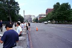 Looking down Pennsylvania avenue to the west.
|
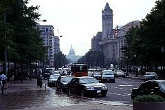 From a nearby street corner you can see all the way down
to the U.S. Capitol. Washington D.C. has streets that generally
run north-south and east-west, but also included in the planning
were several streets that bisect the city. Follow this link and look
on the map for a blue '6 near the White House. That is about where
this picture was taken.
map
|
 I drove into Washington at 5:30 a.m.
and drove to the Visitors center, parking on the street nearby. I waited
in line for about an hour and then at 7:00 a.m. the line for same-day
tickets for the White House tour began to move. There were only 9 tours
given at 15 minute intervals between 10:00 am and noon. I got tickets
for tour #7: plenty of folks left without them. The moral is get there
early. After getting tickets I returned to the hotel for my family.
Here is where the tour of the White House begins. Your congressman
may be
able to get you advance tickets if you give them plenty of warning.
 One walks up the driveway and enters the ? and goes through security.
At the head of the line looking back. You can only get four tickets - they stamp your hand with
ultraviolet dye and one person in every group must have that stamp.
Everyone has to have a ticket - even children.
 You can't take pictures in the White House. I was talking to one of
the guides/security people in one of the "colored" rooms when he quickly
excused himself and went after a guy taking pictures. "I told you once,
you won't listen to me, will you?" he told the guy. The picture taker's
tour was immediately terminated and he was escorted out. I asked a
policeman outside about the film and he said most likely it would be
"accidently" exposed as the man was escorted out.
 Pennsylvania Avenue is closed to automobile traffic for security. The
White House is around the corner to the left. Straight down to the left
is the southeast corner of Lafayette Park, which is across from the White House.
This statue is a memorial to Marquis de
Lafayette, a major-general in George Washington's Revolutionary War Army.
 View along Pennsylvania avenue with the White House to the left.
The near gate is the pedestrian gate, the second gate
is for automobiles. Way down,very hard to see, is another gate for autos.
 The front of the White House.
 The White House was only adopted as the site's
official name during the Theodore Roosevelt
administration. The President's House, as it
was first called, was the first official building of
Washington, constructed before the Capitol or any of
the monuments. George Washington chose the site
for the President's House. He loved the view offered
by the downhill swoop to the Potomac. Despite having chosen its location, George Washington never got the chance to sleep,
much less live, at the White House. But all other presidents since John Adams have lived at the White House.
 A competition was held to find the design for the executive mansion. One of the entries received was a simple Roman design
submitted by none other than Thomas Jefferson. Perhaps had Jefferson signed his own name rather than with pseudonym to his
entry, his design might have won the competition. Instead, the man who won, and received the $500 prize money, was James
Hoban, a little-known, self-taught craftsman from Ireland. His winning design was based on a classical Irish manor near Dublin.
Looking east down Pennsylvania avenue, you see the Treasury building
to the right.
 Originally called the President's Park, Lafayette Park earned its name in 1824
when Revolutionary War hero Marquis de
Lafayette made a visit there. During his say, the city welcomed Lafayette with
numerous dinners and receptions. The park where the festivities took place was re-named in his honor.
For some time, though, the park was also called
Jackson Park, for the statue of Andrew Jackson
that long dominated the area. Installed to honor
Jackson's role at the Battle of New Orleans during
the War of 1812, it was the first equestrian statue
erected in America. The four cannons at the base of
the statue were captured by Jackson from the
Spanish.
 Looking down Pennsylvania avenue to the west.
 From a nearby street corner you can see all the way down
to the U.S. Capitol. Washington D.C. has streets that generally
run north-south and east-west, but also included in the planning
were several streets that bisect the city. Follow this link and look
on the map for a blue '6 near the White House. That is about where
this picture was taken.
map